Mappe
Questo componente aggiuntivo fornisce:
possibilità di memorizzare coordinate geografiche per i membri (latitudine e longitudine),
una mappa pubblica aggiornata che mostra i membri che hanno scelto di essere pubblicamente visibili.
Installazione
Prima di tutto, scaricare il plugin:
Estrai l’archivio scaricato nella cartella plugins di Galette. Per esempio, su Linux (sostituendo {url} e {version} con i rispettivi valori):
$ cd /var/www/html/galette/plugins
$ wget {url}
$ tar xjvf galette-plugin-maps-{version}.tar.gz
Inizializzazione del database
Per poter funzionare, questo componente aggiuntivo richiede diverse nuove tabelle nel database. Vedi Interfaccia di gestione dei componenti aggiuntivi di Galette.
E questo è finito; il plugin Maps è stato installato :)
Utilizzo del componente aggiuntivo
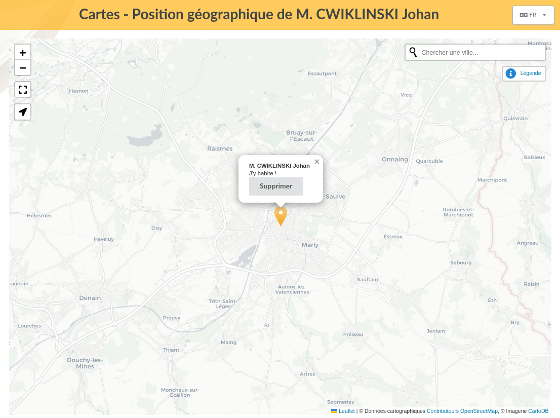
A plugin installato, si aggiunge il gruppo Maps al menu di Galette ogniqualvolta che un membro si connette, contenente la voce La mia posizione. Questa pagina consente all’utente di memorizzare la sua posizione.
Viene inoltre aggiunto un pulsante Geolocalizza durante la visualizzazione di un membro, che consente agli amministratori di impostare le coordinate dei membri.
Inoltre, nell’elenco delle pagine pubbliche viene aggiunta una voce «Mappa» che mostra i membri geolocalizzati aggiornati. Gli amministratori e i membri dello staff vedranno tutti i membri, mentre i membri semplici e i visitatori vedranno solo quelli pubblici aggiornati.
Prima di tutto, i membri entreranno nelle loro coordinate di posizione. Sono disponibili diverse opzioni:
se la città è stata inserita nelle informazioni dei membri, verrà proposto un elenco dei posti possibili (tramite il servizio online Nominatim),
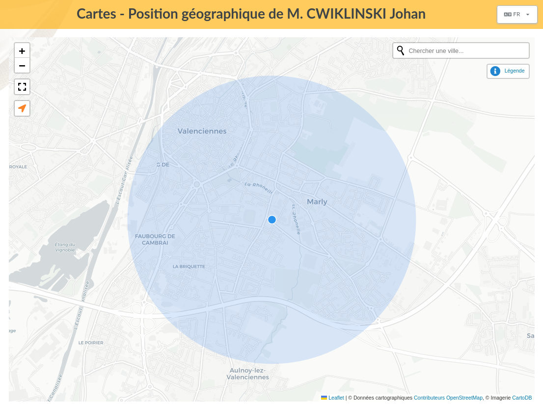
inoltre, una zona di ricerca (fornita da OpenStreetMap),
e anche un pulsante geolocalizza utilizzando le capacità del browser.
La zona di ricerca può essere utilizzata durante il salvataggio della posizione dei membri e durante la visualizzazione delle mappe.
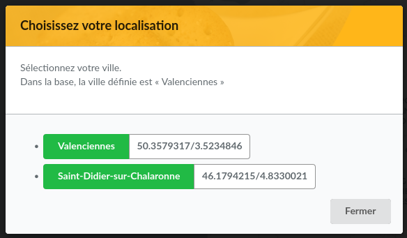
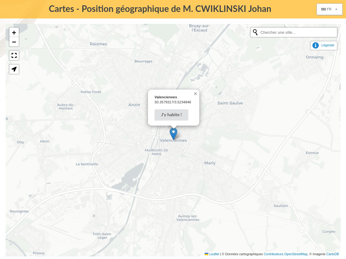
Un membro può definire la sua posizione (con la precisione che vuole) sulla mappa selezionando una delle proposizioni:
Utilizzando il pulsante di geolocalizzazione verrà definita la sua posizione dal browser:
Poi, la posizione del membro viene visualizzata sulla mappa e può essere rimossa: